


EASTERN SIERRA NEVADA REGION
WEST WALKER RIVER PRESERVE
(formerly Aspen Glen Reserve)

TWO RIVERS PRESERVE

BODIE HILLS PRESERVE
TWO RIVERS PRESERVE EXPANSION
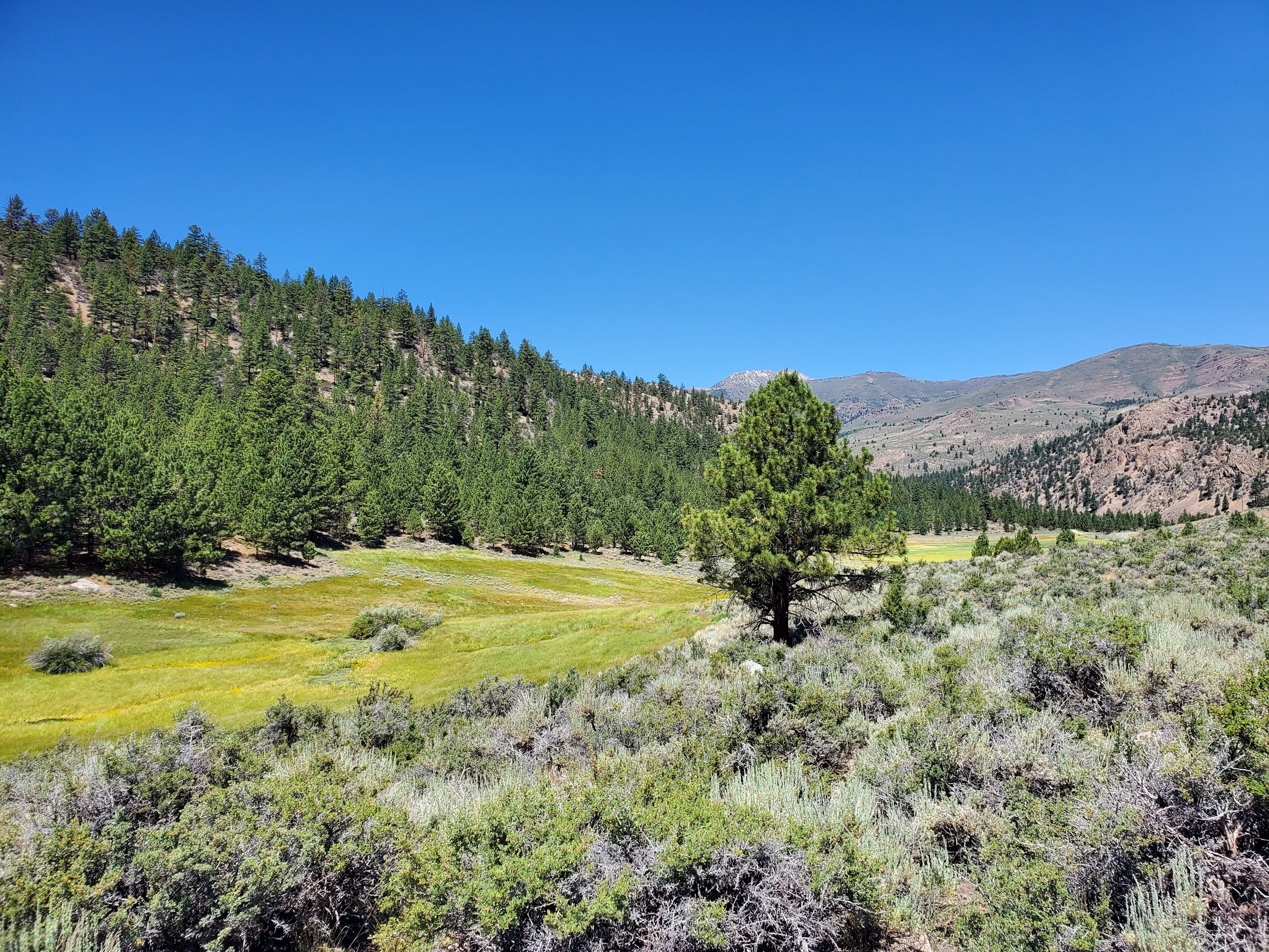
From the air, the blue-gray sagebrush-covered hills of the 2,330-acre Bently Sonora Junction Ranch appear as folds of velvet draped across the Sierran Crest at the Sonora Pass. The West Walker River and numerous creeks run between these folded hills, sustaining a series of lush meadows, wetlands, ponds, all framed by stately aspen, Sierra junipers, and Jeffrey pines. Above the rushing waters of West Walker River, listen closely and one might hear the resonant boom of the bi-state Greater sage grouse, as the males display for females’ attention on their leks.
With more than 60 feet of snow in the High Country, the cold, clear meltwater of the spring runoff will rejuvenate the river, and ultimately run all the way to Walker Lake in Nevada. Junction Reservoir, located on the property, has been identified as the most important location for raising broodstock of the threatened Lahontan cutthroat trout and is critically important to the species recovery, as well as rewildling of the greater watershed.
Once acquired, the ranch will be added to the Two Rivers Preserve, one part of a larger vision. With acquisition funding from the California Wildlife Conservation Board and supporters like you, The Wildlands Conservancy is assembling a series of properties along the course of the West Walker River to protect its free-flowing waters and surrounding hillsides for ecological restoration and free public access in perpetuity.
ABOUT THE REGION
The Eastern Sierra Nevada Region is a remote area of California that includes Mono and Inyo Counties.
The landscape is defined by a basin and range topography featuring alternating landscapes from high mountain ranges and low valleys.
The western side of the region is the steep, eastern escarpment of the Sierra Nevada Mountains; sculpted by the last pleistocene glacial period about 11,000 years ago. East of the Sierra Nevada Mountains is a long chain of valleys including Owens Valley, Round Valley, Long Valley, Mono Basin, Bridgeport Valley, and Antelope Valley. These areas are scattered with volcanic features including cinder cones, lava-dome volcanoes (Mammoth Mountain), the Long Valley Caldera Supervolcano, and the Mono-Inyo Craters. This volcanic rich area includes multiple geothermal areas used for recreation and geothermal power generation.
The central/eastern side of the region is the beginning of the Great Basin Desert, the largest desert in the United States, filled with multiple mountain ranges and desert valleys.
The Mojave Desert borders the region to the south.
The majority of these landscapes are public lands managed by the United States National Forest Service, National Park Service, and Bureau of Land Management; California Department of Parks and Recreation; and the City of Los Angeles.
The region represents the ancestral homelands of the Paiute, Shoshone, and Washo people. The Eastern Sierra is rich in Native American cultural history.
REGIONAL CONTACTS
The Eastern Sierra Nevada Region is currently managed from our Executive Headquarters.
JOHN TRAMMELL
Regional Director
(909) 797-8507
DAVE HERRERO
Preserve Manager
(909) 797-8507